Coastal protection and management
You may also be interested in:
Coastal Protection Authority
Adur District Council and Worthing Borough Council are the Coastal Protection Authority under the Coast Protection Act 1949, and the Flood and Water Management Act 2010 for Worthing's coastline.
We have the responsibility for controlling coastal erosion risk and encroachment from the sea. The legislation does not make it a statutory requirement to defend the coast, but most coastal authorities choose to be active in coastal protection in the interests of public safety.
The Environment Agency has a strategic overview to ensure that decisions about the coast are made in a joined-up manner.
South East Coastal Group
Both Councils are members of the South East Coastal Group. The group covers from Selsey Bill to the Thames Estuary and represents coastal management authorities in the region including district councils, borough councils, unitary councils, county councils, the Environment Agency and Natural England. See:
Coastal defences
The primary coastal defence along Adur and Worthing's coastline is the shingle beach.
To help, if you notice damage to a coastal structure, you can report it to:
See:
Adur's coastal defences
In Adur, the coastline is split between Adur District Council, Shoreham Port Authority and the Environment Agency.
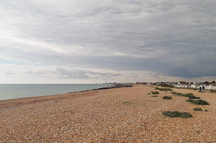
Lancing Beach and Shoreham Beach
- Lancing Beach and Shoreham Beach (6km) is managed by the Environment Agency.
The Environment Agency manages the Shoreham Beach frontage from Western Road in the west to the harbour arm and comprises 33 rock groynes and provides a standard flood defence of a 1-in-a-100-year storm event. The Environment Agency continues to monitor shingle levels and recharge from the harbour arm following shingle loss in storms.
You can click on the map below for a larger zoomable map:
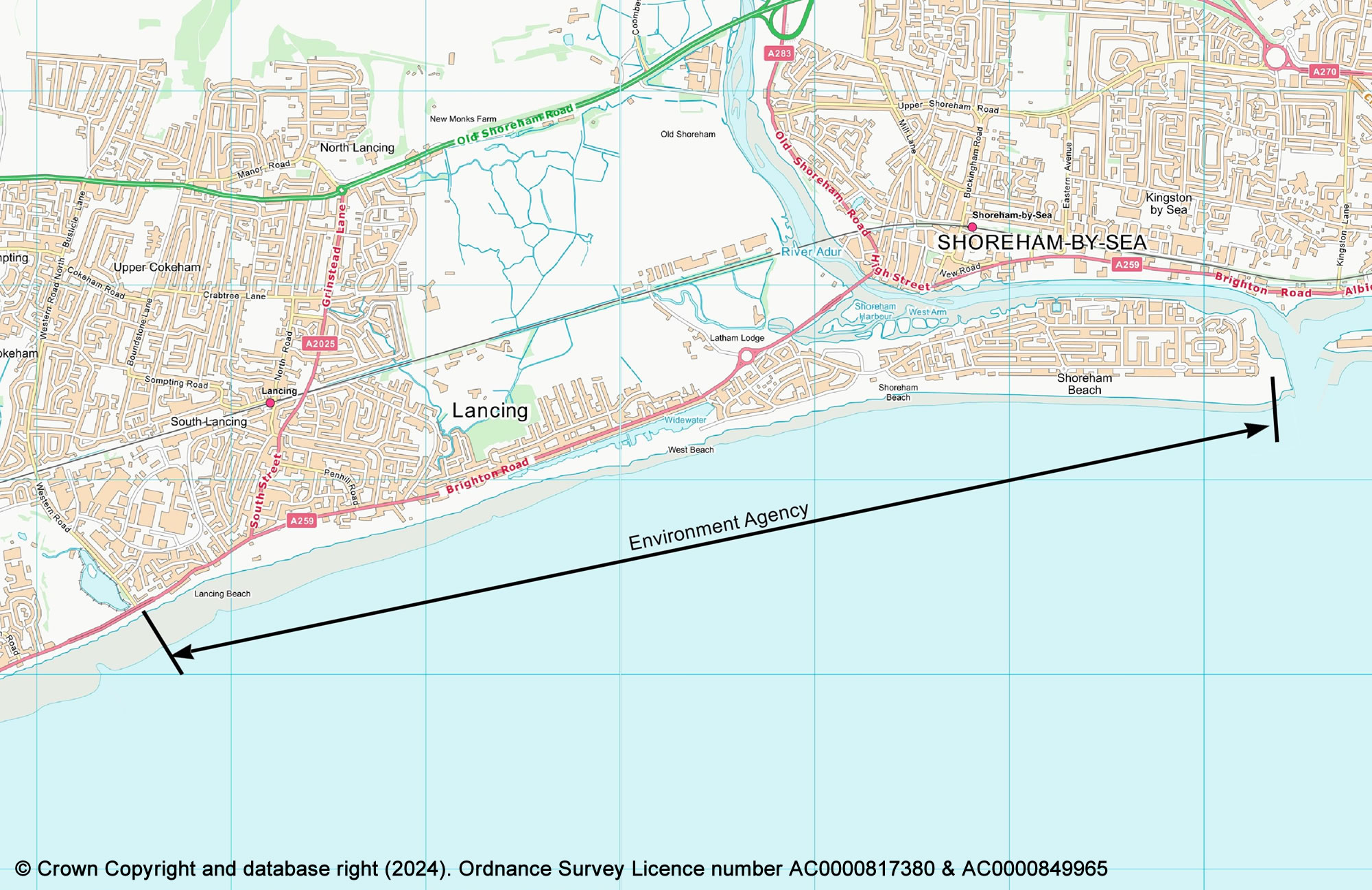
Photo: Lancing Beach - looking east (from The Perch on Lancing Beach Green)
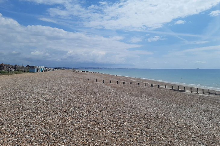
Photo: Lancing Beach - looking west (from The Perch on Lancing Beach Green)
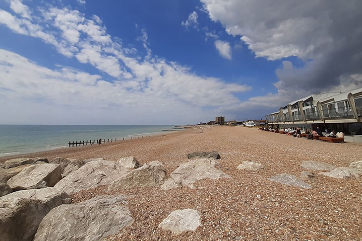
Photo: Shoreham Beach - looking east
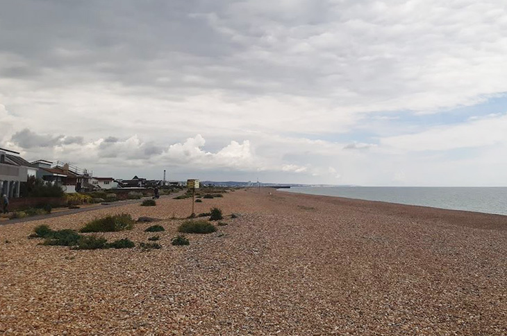
Photo: Shoreham Beach - looking west
Kingston Beach and Southwick Beach
- Kingston Beach in Shoreham (0.4km) is managed by Adur District Council and Shoreham Port Authority.
- Southwick Beach (2.1km) & the Port is managed by Shoreham Port Authority.
Kingston Beach in Shoreham is managed by Adur District Council and Shoreham Port Authority.
Kingston Beach, which is located at the entrance to Shoreham Port, is a shingle beach with timber groynes, breastworks and concrete revetments.
Southwick Beach, which is located from the eastern harbour arm to the Brighton & Hove boundary, is a shingle beach that hosts precast concrete revetments, rock revetments, a steel sheet pile seawall, concrete splash walls and rock and timber groynes.
As the harbour arms stop the natural longshore drift of the shingle along the coastline, the Shoreham Port Authority carry out bypassing works (moving the shingle from Shoreham Beach to Southwick Beach) to ensure the coastal line to the east of the harbour arms receive shingle to replenish the beaches.
You can click on the map below for a larger zoomable map:
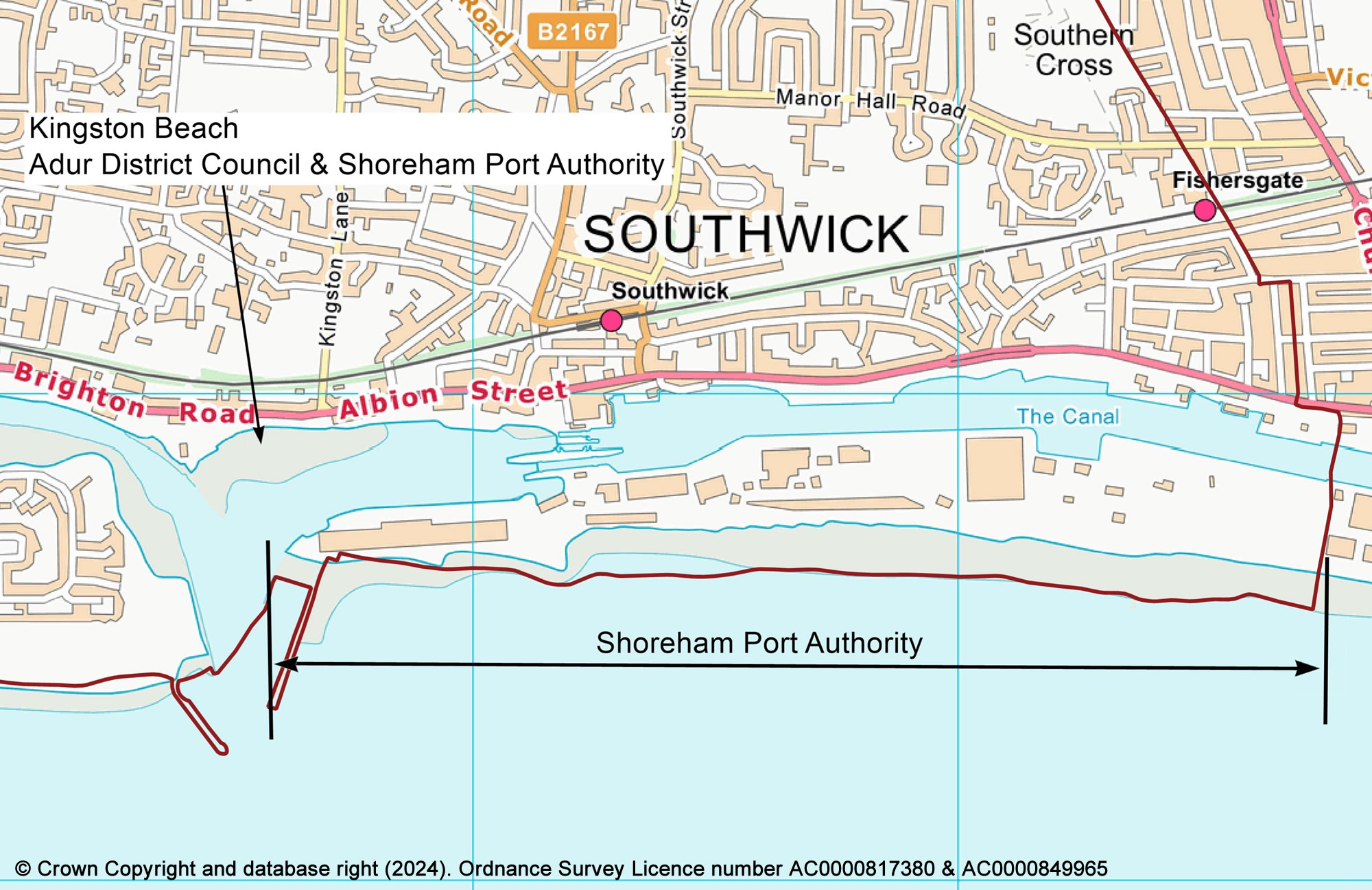
Photo: Kingston Beach - looking east towards Shoreham power station and the lock gates
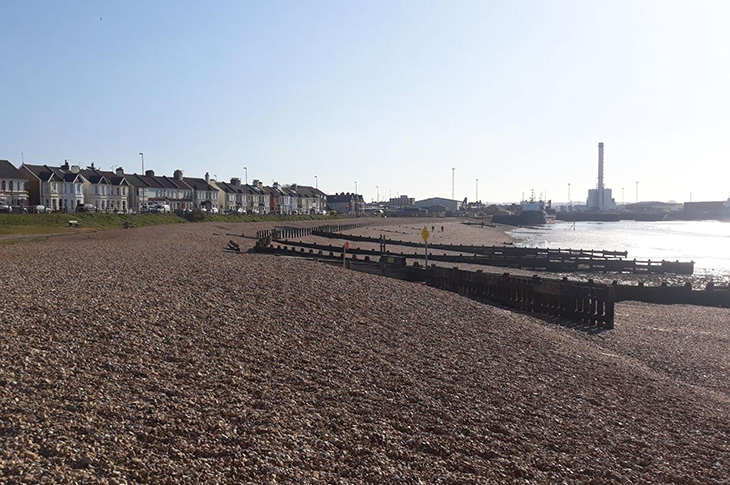
Photo: Kingston Beach - looking west towards the lighthouse and RNLI station
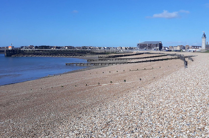
Photo: Southwick Beach - looking east from Carats Café
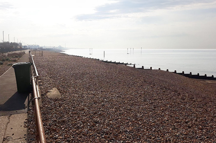
Photo: Southwick Beach - looking west from Carats Café towards Shoreham Harbour entrance
Worthing's coastal defences
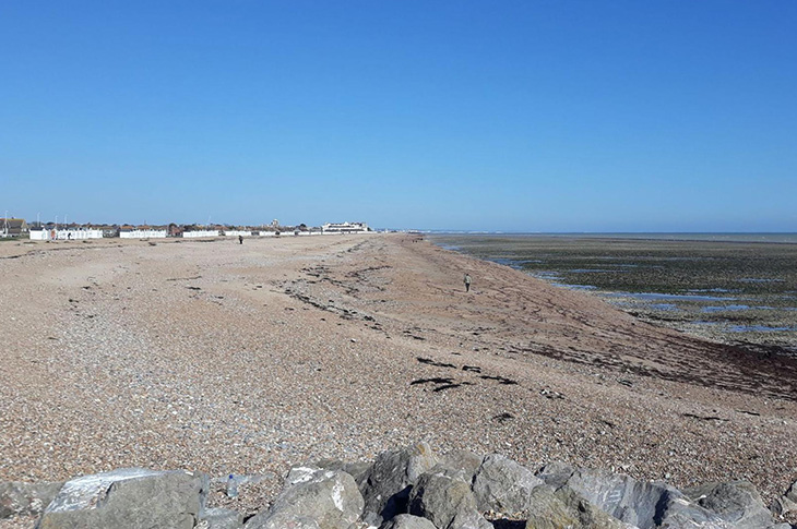
Worthing Beach
- Worthing Beach (7.8km) is managed by Worthing Borough Council.
Worthing's coastline includes 144 timber and 11 rock groynes, three rock revetments and a number of splash wall structures. The defences are all managed by our Engineering team through regular inspections and repaired/replaced on a priority basis.
You can click on the map below for a larger zoomable map:
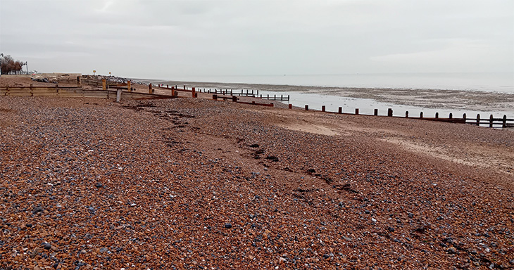
Photo: Worthing Beach - looking west towards pier
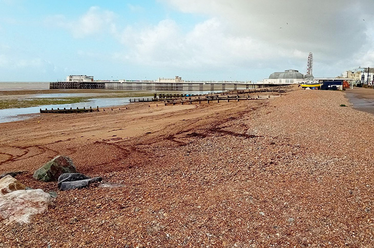
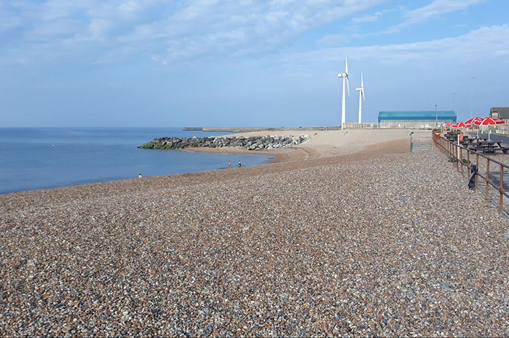
Photo: Worthing Beach - looking west (from near the end of George V Ave)
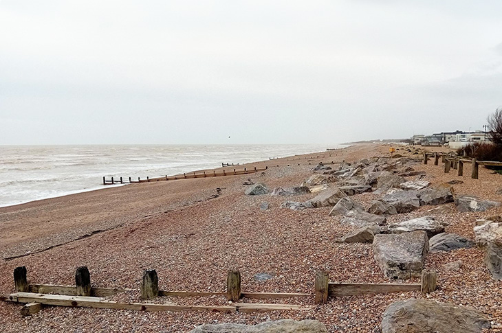
Photo: Worthing Beach - looking east from Goring Greensward
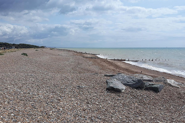
Photo: Worthing Beach - looking east from near Sea Lane Café, Goring
Coastal monitoring
Monitoring is carried out by our Engineering Services team locally and on a regional level by Channel Coast Observatory as part of the national network of regional monitoring programmes. We host the Southeast Coastal Regional Monitoring Survey Team, which surveys the coastline from Selsey Bill to Beachy Head. See:
The survey team utilises modern surveying equipment to scan the region's shingle beaches and cliffs from quad bikes and drones. The regional programme provides a consistent approach to coastal process monitoring. It also gives information for the operational management of coastal protection and flood defence, as well as providing data for the development of strategic shoreline management plans and coastal defence strategies.
Photo: The survey team ATV quad bike at Newhaven

Photo: The survey team quad bikes and UAVs (drones) at Seven Sisters, near Beachy Head

Coast protection plans and strategies
There are a number of documents which detail how the coastal lines are protected from coastal erosion and flooding.
The Shoreline Management Plan (SMP) is a high level plan which states the flooding and erosion management policy for that section of coastline until 2105. These policies are either :
- Hold the line
- Managed realignment, or
- No active intervention
Both Adur and Worthing are included within the Beachy Head to Selsey SMP (12, subsection 3) - Brighton Marina to Littlehampton, which is split into a number of units:
- Adur: 4D15, 4D14 and 4D13
- Worthing: 4D17, 4D16 and 4D15
All of Adur and Worthing's frontages are to 'hold the line'.
The Environment Agency has recently produced a Shoreline Management Plan Explorer web-based platform to view the Shoreline Management Plans and units. See:
The Environment Agency National Coastal Erosion Risk Mapping is an interactive map which shows the estimated land at risk from coastal erosion for three time periods (short, medium and long-term) and estimates how statistically likely it is the coast will retreat and by how many metres. In Worthing, the SMP policy is to 'hold the line' and the mapping shows no retreat of the coastline with interventions in line with the SMP. The coastal erosion risk maps have recently been updated and can be accessed through the SMP Explorer:
The Environment Agency has also recently updated their flood risk mapping tools, which includes the latest data on coastal, fluvial (rivers) and surface water flooding. You can check areas for flood risk:
Coastal protection funding
Both Adur District Council and Worthing Borough Council undertake maintenance work throughout the year to repair and maintain the coastal defences from revenue funding. These are mainly small scale works ranging from replacing missing timber planks to minor timber groyne rebuilds.
The government provides funding for major flood and coastal erosion risk management projects through its Flood and Coastal Resilience Partnership Funding or 'Grant-in-Aid'. The partnership funding does not usually cover the full cost of the works and any shortfall requires contributions from third parties. If or when any partnership funding might be required, those likely to be at risk from flooding or erosion and therefore directly benefiting from the defences may be contacted for contribution.
Local coastal protection schemes
Brighton Marina to River Adur Coastal Scheme
Adur District Council is working in partnership with the Shoreham Port Authority and Brighton & Hove City Council to deliver the Brighton Marina to River Adur Coastal Scheme. Works have been completed in a number of areas to date, with improvement works along Southwick Beach that are programmed for 2030.
Worthing Capital Maintenance Coastal Defence Project
Worthing Borough Council is currently working in partnership with the Environment Agency on a Capital Maintenance Coastal Defence Project, which aims to extend the life of the aged timber groynes by up to 10 years to allow time to develop a long-term project for the whole frontage.
The project includes work on a number of groynes between Seaview Road in the west to Brooklands Park in the east and will be carried out in two phases:
- Phase one: forecast for Autumn 2025, will consist of structural repairs to the timber groynes (pile extensions and replacements, wailing and land tie replacements, planking replacement) and rock groyne root replacements (under shingle to stop outflanking).
- Phase two: forecast for Autumn 2026 and 2027, will monitor the phase one works and natural shingle replenishment over a year and then consider if further shingle replenishment is required.
April 2026 update
The works are ongoing and good progress is being made by the contractors on site. Please see below for an update on each area.
Area 1 - Warwick Road to the Pier & Area 2 - Pier to the Lido
The remaining works have been delayed and are now scheduled to be completed by the end of April 2026.
Area 3, 4 & 5 - Lido to Seaview Road
The Contractor is currently undertaking the minor repairs with the aim for these to be completed by the end of April 2026.
The delays in sourcing the rocks for the repairs at the northern end of the groynes has now been resolved. Following issues obtaining a barge, the Environment Agency has managed to obtain the necessary rocks from another coastal scheme.
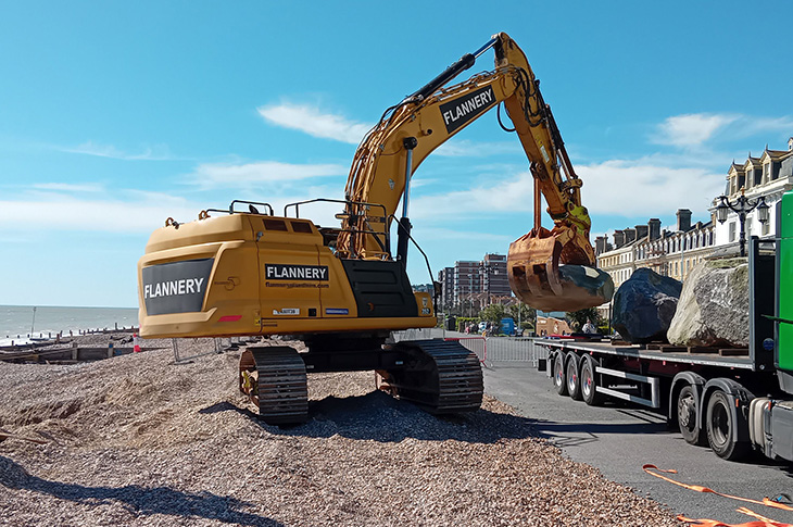
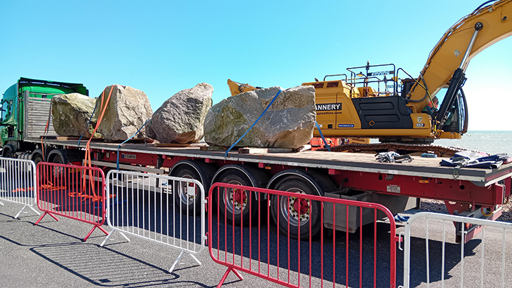
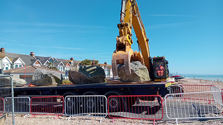
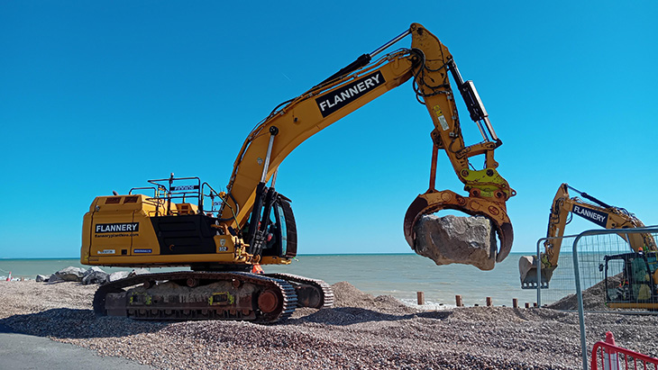
The rocks are being delivered to site by lorry and are being temporarily stockpiled before they are placed at the northern end of the groynes. Each rock weighs between 3 and 6 tonnes, however due to the size of the rocks and weight restrictions it is only possible to deliver a few rocks at a time. It is anticipated that the rock works will be completed in this area by the end of April 2026.
Photos: Worthing beach - rocks being delivered to the beach
Area 6 - Denton Gardens to the Esplanade
These works are progressing well, the majority of the timber repairs have been completed. The rock head works in this area will be undertaken once all the rock works have been completed in area 4 and 7.
Area 7 - Esplanade to Navarino Road
The contractor has installed piles in this section and will be also installing the planks (with strengthening timbers) throughout April 2026.
The rocks required for the rock head work within this area are being delivered and stockpiled on the beach opposite Windsor Road.
Area 8 - Navarino Road to Ophir Road
The contractor has started to install the timber piling repair works in this area. Please see attached the plans for Area 8:
February 2026 update:
The works are continuing and the contractor is currently ahead of schedule. Please see below for an update on each area:
Area 1 - Warwick Road to the Pier & Area 2 - Pier to the Lido
The remaining works are now scheduled to be completed by the middle of March 2026.
Area 3, 4 & 5 - Lido to Seaview Road
The majority of these works have been completed except for a number of small repairs.
The contractor has experienced a delay with the rock head works at the landward end of three groynes. The rocks are being sourced from Wales and they are being delivered to their local supplier by barge, however due to all the recent storms they have not been able to transport the rocks. These works have therefore been delayed by a number of weeks. We will keep you updated once we have more information.
Area 6 - Denton Gardens to the Esplanade
The contractor has now started work in this area and the works are progressing as planned.
Area 7 - Esplanade to Navarino Road
The contractor is scheduled to start on this area at the beginning of March 2026.
Photos: Worthing beach near Splashpoint Leisure Centre
January 2026 update:
The works are proceeding well, please see below for an update on each area.
Area 1 - Warwick Road to the Pier
The majority of the works are now complete, with a small number of the repairs in this area remaining.
Further discussions in relation to the design have resulted in the minor delay to the repair works to the groyne immediately to the east of the Pier. While this is resolved by the Environment Agency in discussion with their consultants, their contractor has moved onto areas west of the Lido. Once these works have been completed the contractor will return to repair the remaining work in Area 1 before moving on to Area 6 (Denton Gardens to the Esplanade).
This work is currently scheduled for the middle/end of February 2026
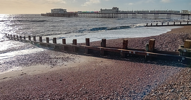
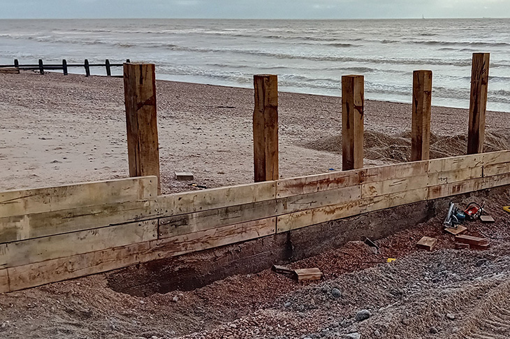
Photo: before works
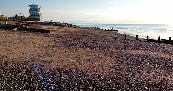
Photo: after works
Area 2 - Pier to the Lido
The repairs in this section are also nearing completion. The timber groynes have been repaired, and large rocks have been installed at the landward end of two groynes where the timber is in a poor condition. The rocks have been covered with shingle and they will only be exposed when the shingle beach is eroded during a storm.
Areas 3, 4 and 5 (Lido to Seaview Road)
The contractor is currently repairing the timber groynes in Areas 3, 4 and 5. To help improve efficiencies the contractor is undertaking all the pile repair works first to all the identified groynes within each work area. They will then complete all the strengthening timber repairs, replace the missing planks and cut down the piles to the required heights. This ultimately means that instead of the contractor undertaking all the required work on each groyne before moving on to the next groyne, the works will be completed over several separate occasions.
The contractor will also be placing large rocks at the landward end of a few of the groynes where the timber is in poor condition. Once the rocks have been installed they will be covered with shingle and they will only be exposed when the shingle beach is eroded during a storm.
The works in this area are currently scheduled to be completed by the middle/end February 2026.
Area 6 (Denton Gardens to the Esplanade)
This work is currently scheduled to start around the end of February 2026.
Please see attached plans for works Area 6:
December 2025 update:
The Environment Agency's contractor, Volker Stevin, is proceeding well with the works.
The majority of the repair works within works Area 1 are nearing completion and the contractor hopes to make a start in works Area 2 (Pier to Lido) prior to Christmas.
The snapped piles and the worn piles have been extended/strengthened. This is achieved by placing and bolting new piles to the landward side of the existing piles.
Missing planks are then fixed to the newly extended piles. Once the missing planks have been installed the tops of the piles will be cut down to the correct height.
Works will close down over Christmas from 22nd December 2025 to 5th January 2026.
Please see the work plans for Areas 3, 4 and 5 which will commence in the new year:
 Worthing Coastal Scheme Works - Phase 1 - Timber Groyne Repairs - Works Area 3 (2,116KB)
- Worthing Coastal Scheme Works - Phase 1 - Timber Groyne Repairs - Works Area 4 (2,097KB)
- Worthing Coastal Scheme Works - Phase 1 - Timber Groyne Repairs - Works Area 5 (1,189KB)
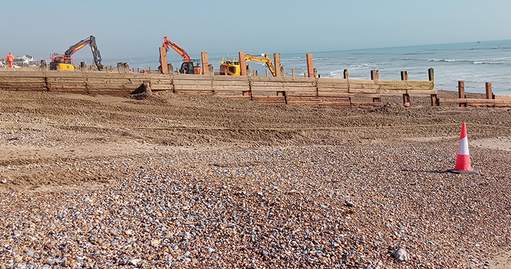
Photo: Worthing Beach - Installing new piles
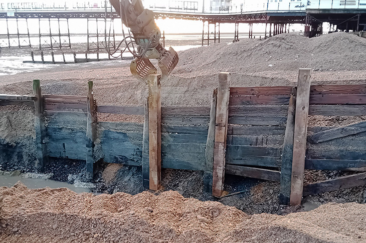
Photo: Worthing Beach - Digger on the beach
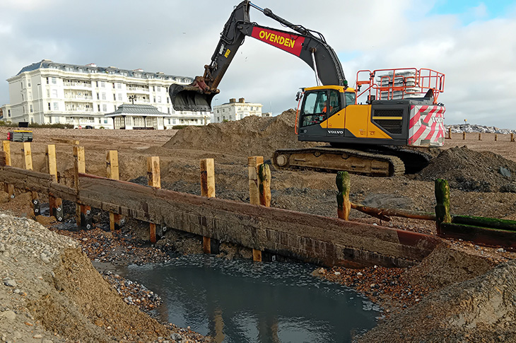
Photo: Worthing Beach - Planking works
October 2025 update:
We are pleased to announce that the £5m scheme has now been approved. It's primarily being funded by the Department for Environment, Food & Rural Affairs (Defra) through its National Coastal Erosion Risk Management and Flooding Grant in Aid. Worthing Borough Council is contributing £400,000 towards the scheme and will continue to maintain the sea defences after the repair works.
The Environment Agency is overseeing the project. To make the phase one groyne repair works more manageable for their contractor VolkerStevin, the works have been broken down into 10 areas, as shown by the attached plan:
Overview plan:
Works will commence at Area 1 and then once the works have been completed the contractor will move onto Area 2 and so forth. However, there will be a short overlap between ending the current area and starting the next area.
The repair works are scheduled to commence on site at Area 1 on week commencing the 10th November 2025. All of the works are expected to take approximately seven months to complete.
A poster explaining the types of work which will be undertaken will be erected on site at each work area. Please see works Areas 1 and 2 plans for more information.
Area plan 1 and 2:
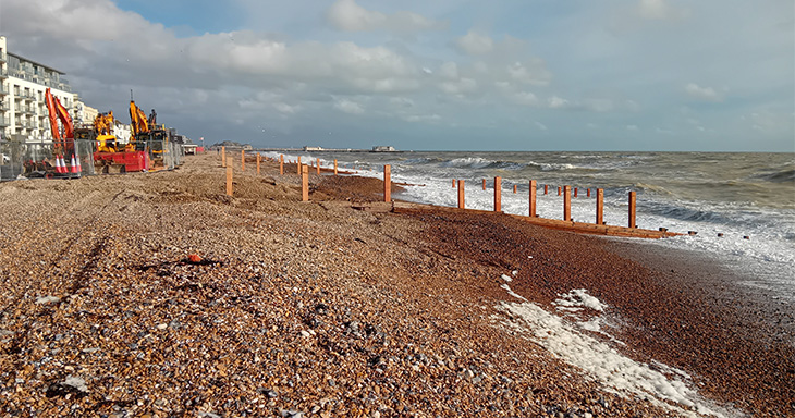
Worthing's primary defence against coastal flooding is the shingle beach; the timber groynes are the means to control the shingle.
We will not be undertaking repair works to all of the groynes, as some still maintain the shingle volumes to the required levels. For this reason, you may also find that the southern end of the timber groyne is not repaired - this is due to the amount of available funding being directed to those parts that are more critical to preventing coastal flooding.
The timber groyne repair works are primarily to extend snapped piles, strengthen worn piles and to replace missing sections of planks. On a few groynes we will be placing large rocks at the northern end of the groyne where the timber is completely rotten. All of these types of works have previously been undertaken to the groynes.
It's not our intention to fully close the beach in any of the works areas. The contractor will only close the area where they are working, and at the end of each day's work the affected section of beach will be opened to the public.
The contractor will be using the Brooklands Brighton Road western car park for their main compound. Therefore this car park will be closed from 3rd November 2025 for 7 months. The eastern car park will remain open.
The contractor will also have a compound on the beach at each of the work areas.
As part of these works, we will also be undertaking environmental enhancements to the beach. Along the beach there are a number of plants, which are referred to as vegetated shingle. Some of these plants include Red Valerian, which is an invasive species and stifles the growth of other plants.
To enhance this section of our seafront, we will be removing sections of Red Valerian and replacing it by growing a number of plants using seeds collected from nearby sources or sourced from the Millennium Seed Bank at Wakehurst (Kew). This will improve the flora and fauna along this section of the beach. Please see the attached environmental enhancement poster below.
For details of the works see:
- Worthing Coastal Protection Works - Phase 1 - Timber Groyne Repairs - Works Area 1 (2,123KB)
- Worthing Coastal Protection Works - Phase 1 - Timber Groyne Repairs - Works Area 2 (2,099KB)
- Worthing Coastal Protection Works - Phase 1 - Environmental Enhancements (1,696KB)
Frequently asked questions (FAQs):
As the works progress we will update this webpage.
Who is running the scheme?
The Scheme has been developed by the Environment Agency (EA) in partnership with Worthing Borough Council. The EA is the main lead for the Scheme.
Who is undertaking the work?
The main contractor is VolkerStevin.
How much are these works costing, and who is paying for them?
The construction works are costing approximately £5m. Worthing Borough Council is contributing £400k, while the remaining funds are being provided by the Department for Environment, Food & Rural Affairs (Defra) through its National Coastal Erosion Risk Management and Flooding Grant in Aid.
What is Worthing's sea defence?
Worthing's primary sea defence is the shingle beach. The timber and rock groynes (the barriers sticking out to sea) are the means to control and retain the shingle beach.
Why are you only repairing the groynes from Seaview Road to Brooklands Park?
This section of the beach is the most vulnerable to coastal flooding due to the proximity of the properties and no secondary protection.
From George V Avenue to Seaview Road, there is a wall which protects against the sea washing across the promenade and flooding the land behind.
From George V Avenue to Sea Lane Cafe the beach is very wide and can currently withstand a 'one-in-200-year flood event'. This is a flood that has a 0.5% chance of occurring in any given year, or a 0.5% Annual Exceedance Probability (AEP).
What maintenance works have been undertaken in the past?
Worthing Borough Council repairs the coastal defences under the Coastal Protection Act 1949. The defences have been continually maintained over the years. However, the council's budget is only £100k per year, which is rather small considering there are 147 timber groynes and 10 rock groynes to maintain.
The majority of the timber groynes are also at the end of their lives. A typical softwood groyne has a lifespan of 25 years, while a typical hardwood groyne is around 40 years. The majority of the groynes within Worthing are softwood and were installed around 1988/90, so they are more than 35 years old.
As the groyne ages, the metal fixings corrode and the timbers are constantly worn away by the movement of the sand and shingle beach, and eaten by marine borers (gribble, a marine based woodworm). This weakens the strength of the timber which then causes it to fail during storms.
As the years have progressed, the amount of piling work has increased which exceeds the council's budget.
Are you replacing the timber groynes for rock groynes?
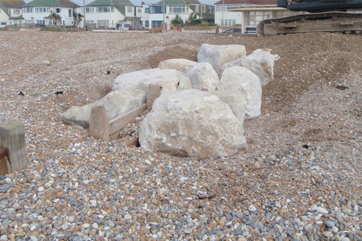
No, the timber groynes are being repaired with timber. Rocks are only being used at the landward end of the groynes beneath the shingle to prevent outflanking. This is where the waves run up the sides of the groynes and erodes the shingle beach where the timber groyne is completely rotten.
Photo: Outflanking at northern end of groyne
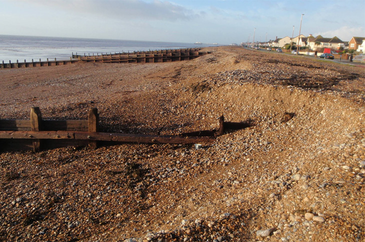
Photo: Rocks placed to fill rotten section of groyne
I thought the council was planning to replace all the timber groynes with rock groynes?
In 2019, it was originally envisaged to replace the timber groynes with rock groynes. However, following discussions between the EA and the council, and due to the amount of funding required, it was agreed to undertake a large scale capital maintenance repair scheme to keep the coastal defences going for the next 10 years.
During those 10 years, a large-scale coastal defence scheme will be developed by the EA and Worthing Borough Council to protect the town for the next 50 years. The public will be consulted throughout the scheme to make sure it meets the aspirations of the residents.
What works are you undertaking?
As part of the first phase of works, we will be repairing snapped piles, strengthening worn piles and replacing the sections of missing planks. Large rocks will be placed at the northern ends of the groyne where the timber is completely rotten. The rocks will be buried under the shingle and are only uncovered during storms. All of these repair works have been undertaken to the timber groynes in the past, however, this scheme will be undertaking them on a larger scale.
Why are you not repairing every groyne?
Due to our limited budget, it's not possible to repair all of the groynes. As the shingle beach is Worthing's main defence against coastal flooding and the groynes are the means to control the shingle, we will only be repairing the timber groynes that are not controlling the shingle to the required beach levels.
You will also find that the southern ends of the groynes aren't being repaired as they only play a small part in retaining the shingle.
Worthing Borough Council will continue to maintain the defences once the main repairs works have been completed.
Will you be closing the beach?
The works will be broken down into 10 areas and the contractor will complete each area before moving on to the next area. To improve efficiencies, there may be a short overlap between when one area ends and the other area commences. We will aim to keep these to a minimum.
It's our intention that the beach will not be fully closed during the works. The contractor will only be closing the section of beach where they are working, however, we would recommend that the public keep away from the work areas. At the end of each day's work the beach will be opened up to the public, (normally at high tide).
We will keep everyone informed of the progress and when each area will be starting and completing.
When will the contractor be undertaking the work?
Works will commence at Area 1 on week commencing the 10th November 2025.
The works will be undertaken Monday to Friday and primarily undertaken at low tide, however, some works can be undertaken at high tide.
Why are you undertaking these works now when the town is already being affected by other construction projects?
It has taken more than five years to obtain funding and the necessary approvals for this project to proceed. The approval has coincided with the construction of the Worthing Heat Network, however, as part of the funding requirements and Marine Management Organisation (MMO) licence, the works must be started this financial year. The works have deliberately been scheduled to be undertaken during the winter months so it doesn't affect the summer trade. We will aim to keep the disruption to a minimum, but these works are essential to protecting Worthing from coastal flooding.
Why are the works broken down into two phases?
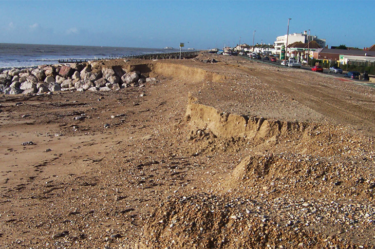
It's preferable to allow the shingle beach to build up naturally. Importing shingle is very expensive and can result in the beach cliffing (see photograph below) due to the high sand content and UXOs (unexploded ordnance) can be found within the imported shingle, as it is dredged from the sea bed.
The shingle levels will be monitored and if necessary in September 2027 and 2028 shingle movement works (recycling) will be undertaken. This will involve moving shingle from areas of the beach where there is excess shingle to areas where there are insufficient levels.
Photo: Example of cliffing
How do you plan to monitor the beaches?
We will be using the beach survey data provided by the National Network of Regional Coastal Monitoring Programmes, which survey the beach twice a year (spring and autumn). The data is freely available to the public and accessible on the:
I have a beach hut, will it be affected during the works?
The work will not affect access to your beach hut. Area 5 comprises all of the beach huts, and we will be writing to the beach hut users prior to the commencement of the works.
I have a fishing boat, how will the work affect me?
We will be keeping the fishing community constantly updated throughout the scheme and aim to keep any disruption to a minimum. We will be liaising with the fishing boat users throughout the project and provide updates prior to any works being undertaken in those areas. To help assist us, we would be very grateful if fishers could move any equipment which isn't being used as far north as possible.
I have a concession in the area of the works, how will it affect me?
The majority of the concessions will not be affected by the works. However, for certain concessions you will be contacted by the council's concession team to see if you can be temporarily moved during the works in your area.
What timber are you using to repair the groynes?
We are using European oak (hardwood) and American/Canadian (Pacific grown) Douglas fir timber (softwood). We are using Douglas fir as the majority of the groynes within Worthing were constructed from this type of timber. We use American/Canadian timber as the timber is more durable than the UK/European timber. The European oak is being used for groynes which were constructed from hardwood which are found primarily in the town centre.
All of the timber is natural and has no preservatives which can damage the environment.
When will you be starting the larger project to replace the coastal defences
Once the Phase 1 construction phase has been completed, we will continue discussions with the Environment Agency in relation to a longer-term strategic project for the Worthing coastal frontage.
Due to the complexity and required funding of the scheme, it's envisaged that it will take 10 years to design the scheme. Public consultation will be undertaken throughout the project to ensure that the design meets the expectations of the local community and stakeholders.
As part of the scheme will you be providing access down the beach for disabled users?
The scheme does not include provision for disabled access to the beach. The scheme is specifically funded to improve the condition of the timber groynes.
Disabled access to the beach has been separately considered by the council and by many other coastal authorities and no suitable and safe solution has been found. This is down to a number of factors, including that Worthing's tidal range is very wide.
The height from the top of the beach down to the sand is approximately 6.5m. Providing a ramp over that height to current Disability Discrimination Act standards would result in a very large ramp more than 150m long. As we have a mixed sand and shingle beach which is very mobile, the ramp would need to be cleared on a daily basis. The stability of the sand beach varies and it can be very soft in places.
There would also be safety concerns to an accessible ramp as the sand foreshore is very flat, meaning the sea can come in very quickly and catch people unaware.
If you have any other questions please contact us at:
February 2025 update:
The scheme design is progressing and final design will now be submitted to the Environment Agency for approval in June 2025. The plan to commence works in Autumn 2025 is still on target.
As part of the design process the Environment Agency has submitted the proposed scheme to the Marine Management Organisation (MMO) to obtain the necessary licences to undertake the works. The MMO has jurisdiction on works which are undertaken below the Mean High Water level within English waters.
The application can be viewed and commented upon on the:
The MMO will also accept representations via the following formats:
- By email to marine.consents@marinemanagement.org.uk
or alternatively - By letter addressed to: Marine Management Organisation, Lancaster House, Hampshire Court, Newcastle upon Tyne, NE4 7YH
The consultation period is 28 days and ends on 26th March 2025.
Notices will be erected along the frontage.
August 2024 update:
The scheme has progressed to the final stages of the design, which will then be submitted to the Environment Agency for approval in January 2025.
As part of the design process, consideration must be given to the scheme's impact on the Environment. As this scheme is considered unlikely to have significant effects on the environment, the Environment Agency's intention is not to prepare an Environmental Statement in respect to them.
The justification for this decision is outlined in this published notice:
Anyone wishing to make representations in relation to the likely environmental effects of the proposed improvement works can do so in writing, to the address specified below, within 30 days of the date of publication of this notice (Saturday 14th September 2024).
- Kenny Yong (Project Manager)
kenny.yong@jbaconsulting.com
35 Perrymount Road, Haywards Heath, West Sussex, RH16 3BW

Need assistance with this service?
Get in touch:
Engineers, Technical Services
Problem with this page?
Page last updated: 10 April 2026